
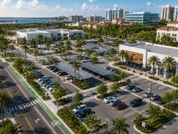
Before a new development breaks ground, before a municipality invests in roadway improvements, and before community leaders respond to concerns about congestion or speeding, one thing becomes clear: transportation decisions are only as strong as the information behind them. In Florida’s rapidly growing communities, accurate data helps decision-makers understand existing conditions, anticipate future needs, and create safer, more efficient transportation systems. A comprehensive traffic study in Florida provides the foundation for these decisions, while an experienced traffic engineer in Florida translates that data into practical recommendations that support safety, mobility, and long-term planning.
Growth can be exciting, but it also brings challenges. More homes, businesses, schools, and healthcare facilities often mean more vehicles, more pedestrians, and increased pressure on existing infrastructure. Without reliable data, transportation planning can become reactive instead of proactive.
For municipal leaders, developers, and community organizations looking to make informed transportation decisions, partnering with a data-driven engineering team can provide clarity long before concerns become costly problems. MAPS Engineering helps clients across Florida transform transportation data into practical solutions that support approvals, improve mobility, and enhance public safety.
Why Data Matters in Traffic Engineering
Traffic engineering is often misunderstood as simply counting cars. In reality, it is about understanding how people, vehicles, cyclists, transit users, and pedestrians interact within a transportation network.
Data helps remove guesswork from decision-making.
Instead of relying on assumptions, engineers collect measurable information that reveals how roads and intersections are performing. This information allows communities to identify risks, forecast future conditions, and evaluate potential improvements before implementing costly changes.
For example, a busy intersection may appear to function adequately during midday hours. However, peak-hour data might reveal long vehicle queues, excessive delays, or turning conflicts that create safety concerns. Without collecting and analyzing traffic data, these issues can remain hidden until they become more serious.
This is why municipalities, developers, and community organizations increasingly rely on transportation studies to guide planning decisions.
What Data Is Collected During a Traffic Study?
A well-executed traffic study in Florida involves much more than vehicle counts. Engineers gather multiple types of information to develop a complete picture of transportation conditions.
Common data collection efforts include:
- Traffic volume counts
- Turning movement counts at intersections
- Speed data
- Crash history analysis
- Pedestrian activity observations
- Bicycle activity observations
- Queue length measurements
- Intersection delay studies
- Site access evaluations
- Land use and trip generation data
Each data set tells part of the story.
Traffic volume counts show how many vehicles use a roadway. Turning movement counts reveal where vehicles are entering and exiting intersections. Speed studies help determine whether vehicle speeds align with roadway conditions. Crash history reviews identify recurring safety patterns that may require attention.
Most importantly, these data points work together. A single number rarely explains a transportation challenge. Engineers compare multiple sources of information to understand how a roadway truly functions.
How Engineers Turn Data Into Safer Roads
Collecting information is only the first step. The real value comes from interpretation.
An experienced traffic engineer in Florida uses traffic data to identify patterns that may indicate safety concerns. These concerns can include speeding behavior, crash trends, poor visibility, access conflicts, pedestrian risks, or operational deficiencies at intersections.
Consider a common scenario.
A municipality receives repeated complaints about speeding near a school zone. Residents believe traffic calming measures are necessary. Rather than making immediate changes based solely on public perception, engineers conduct a speed study and analyze crash history.
Sometimes the data confirms the concern and supports improvements such as enhanced signage, roadway modifications, or traffic calming strategies. Other times, the data reveals a different issue entirely, such as visibility limitations or intersection conflicts.
This approach ensures that solutions address actual conditions rather than assumptions.
The Role of Technology in Modern Traffic Analysis
Today’s transportation systems generate more information than ever before, and modern technology helps engineers make sense of it.
Advanced traffic analysis often incorporates:
- Video-based traffic data collection
- Traffic simulation software
- Geographic Information System (GIS) mapping
- Forecasting and modeling tools
- Mobility data collection technologies
- Safety analysis platforms
Traffic simulation is particularly valuable.
Rather than waiting for a roadway improvement to be built, engineers can model different scenarios digitally. They can evaluate how a new turn lane, signal adjustment, access modification, or development project may affect traffic operations before construction begins.
This allows decision-makers to compare options and identify the most effective solution with greater confidence.
However, technology has limitations.
Simulation tools and forecasting models are only as reliable as the data that supports them. Engineering judgment remains essential. The best outcomes occur when technology is combined with local expertise and field experience.
How Traffic Projections Support Better Planning
One of the most important responsibilities of a traffic engineer is helping clients understand future conditions.
Transportation systems must be planned not only for today’s traffic but also for tomorrow’s growth.
Traffic projections use current traffic counts, development activity, trip generation data, regional growth trends, and accepted engineering methodologies to estimate future travel demand.
For developers, this information helps determine whether roadway improvements may be necessary to support a project.
For municipalities, projections help prioritize infrastructure investments and identify future capacity needs.
For community organizations, projections provide insight into how proposed developments may affect local mobility.
It is important to be realistic, however.
Traffic projections are not crystal balls. They are based on available information and reasonable assumptions. Unexpected changes in development patterns, economic conditions, or travel behavior can influence actual outcomes.
Still, when performed correctly, projections provide valuable guidance for planning and decision-making.
A Real-World Example of Data-Driven Decision Making
Imagine a proposed mixed-use development near a growing suburban corridor in South Florida.
Initial concerns focus on whether additional traffic will overwhelm nearby intersections during peak commuting hours. Residents worry about congestion. Local officials want to understand potential impacts before granting approvals.
Engineers begin by collecting turning movement counts, traffic volumes, speed data, and intersection delay information. They then evaluate future traffic conditions using traffic simulation and forecasting tools.
The analysis reveals that the development itself is not the primary issue. Instead, a nearby intersection experiences operational challenges due to inefficient signal timing.
Rather than requiring costly roadway widening, engineers recommend signal timing improvements and targeted access modifications.
The result?
Traffic flow improves, delays decrease, project approvals move forward, and public concerns are addressed using objective data.
This is a perfect example of why transportation planning works best when decisions are supported by evidence rather than assumptions.
Improving Mobility Beyond Vehicles
Modern transportation planning is no longer focused solely on cars.
Communities increasingly expect transportation systems to accommodate multiple modes of travel, including walking, cycling, transit, rideshare services, and freight movement.
MAPS Engineering approaches mobility planning with a broader perspective. Their work considers:
- Pedestrian accessibility
- Bicycle connectivity
- Transit integration
- Curb lane management
- Transportation demand management
- Complete Streets strategies
- Wayfinding improvements
This holistic approach helps create transportation networks that work better for everyone.
In many Florida communities, mobility challenges are not caused by a lack of roadway capacity alone. Sometimes access management, pedestrian accommodations, or parking operations play equally important roles in overall transportation performance.
Why Local Florida Experience Matters
Florida presents unique transportation challenges.
Rapid growth, seasonal tourism, mixed-use development, coastal communities, suburban expansion, and evolving mobility demands create conditions that vary significantly from one region to another.
A traffic engineer in Florida must understand more than transportation principles. They must also understand local agency requirements, municipal review processes, county standards, and where applicable, FDOT expectations.
This local knowledge helps projects move more efficiently through review while ensuring recommendations align with community needs.
MAPS Engineering brings decades of Florida-specific experience across residential, commercial, educational, healthcare, and municipal projects. Their integrated approach combines traffic engineering, parking planning, and mobility solutions to support safer and more efficient transportation systems throughout the state.
Common Questions About Traffic Data and Analysis
1. What data is collected during traffic studies?
Traffic studies typically include vehicle counts, turning movement counts, speed data, crash history, pedestrian and bicycle activity, queue lengths, intersection delay measurements, site access observations, and land use information. Together, these data points help engineers understand how transportation systems are functioning and where improvements may be needed.
2. How do engineers identify safety concerns?
Engineers evaluate crash patterns, traffic speeds, roadway geometry, visibility, pedestrian activity, intersection operations, and conflict points. They compare multiple data sources to identify trends that may indicate safety risks and recommend practical solutions.
3. What technology is used in traffic analysis?
Modern traffic analysis often uses video-based traffic collection tools, traffic simulation software, GIS mapping systems, forecasting models, mobility data collection technologies, and safety analysis platforms. These tools help engineers evaluate existing conditions and test future scenarios.
4. How accurate are traffic projections?
Traffic projections are based on accepted engineering methods, current traffic conditions, development assumptions, growth forecasts, and transportation models. While they are not guarantees of future conditions, they provide valuable planning guidance when supported by accurate data and local context.
Conclusion
As Florida continues to grow, transportation decisions become increasingly important for municipalities, developers, and community organizations. Data provides the insight needed to move beyond assumptions and make informed choices that improve safety, support mobility, and enhance long-term planning outcomes.
Whether evaluating roadway operations, forecasting future demand, identifying safety concerns, or supporting project approvals, a well-executed traffic study in Florida serves as a critical planning tool. Working with an experienced traffic engineer in Florida helps transform complex transportation questions into practical, data-supported solutions that benefit communities today and prepare them for tomorrow.
If your project requires transportation expertise, MAPS Engineering offers comprehensive traffic engineering, parking planning, and mobility solutions tailored to Florida’s unique transportation landscape. Reach out to their team to start a conversation about how data-driven planning can support safer roads, smoother approvals, and stronger mobility outcomes for your community or development project.